Rural listings in Puerto Rico are full of two- and three-letter codes: A-G, A-P, R-G, B-Q, CR, SRC, SREP. They decide what you can build, whether you can subdivide, whether the wellness retreat or the horse operation you have in mind is a permitted use or a two-year permitting project. Most listings print the code and explain nothing. This guide explains the system, what the common rural codes mean, and how to check a specific parcel before you make an offer.
How land classification works in Puerto Rico
Unlike the mainland, where zoning is written county by county, Puerto Rico uses one island-wide system. The Puerto Rico Planning Board (Junta de Planificación, or JP) publishes the Reglamento Conjunto, the joint regulation that defines every zoning district and its permitted uses, and the Island-wide Land Use Plan. Municipalities that have adopted their own land use plan (Plan de Ordenación Territorial, or POT) apply those districts to their territory and may carry delegated permitting authority as "autonomous municipalities". Permits themselves flow through the Permit Management Office (Oficina de Gerencia de Permisos, OGPe) or the municipal permit office, under the Single Permit (Permiso Único) framework.
Every parcel therefore carries two layers of classification: a soil class from the land use plan, and a district code (calificación) from the zoning map. You need both to understand what a property can do.
The first layer: SRC, SREP and urban soil
- Suelo Urbano (SU). Land inside the developed urban footprint, with infrastructure in place.
- Suelo Urbanizable. Land programmed for future urban expansion.
- Suelo Rústico Común (SRC). Ordinary rural land outside the urban footprint, not slated for urbanization. Most mountain farms are SRC.
- Suelo Rústico Especialmente Protegido (SREP). Rural land protected for a specific reason: productive agricultural soils, forests and watersheds, scenic corridors, ecological value, or hazard. Development is limited to what is compatible with the protected value, and changing it is difficult.
Listings sometimes give these as percentages, such as "76 percent SRC, 24 percent SU" for a parcel that straddles the edge of town. A property entirely in SREP is not necessarily unbuildable, but you should assume it is for anything beyond the agricultural or residential use the protection contemplates.
The second layer: district codes you will see on rural listings
- A-G, Agrícola General. The general agricultural district and the most common code on mountain fincas. Intended for crops, pasture, livestock, forestry and the residences, barns, sheds and other accessory structures that serve them. A principal dwelling for the owner or operator is contemplated, subject to lot, setback and permit rules.
- A-P, Agrícola Productivo. Productive agricultural land: the island's best soils and the legislated agricultural reserves (for example in the Lajas Valley, Las Piedras and the south coast). Non-farm uses are tightly restricted, and several reserve statutes set a 50-cuerda minimum for any agricultural segregation.
- R-G, Rural General. A mixed rural district that often permits, alongside farming and residences, income uses such as agro-tourism, agro-lodging, bed and breakfast operations, small hospitality concepts and renewable energy projects. Listings for R-G parcels frequently promote exactly those uses.
- CR, Conservación de Recursos. Resource conservation: land protected for its natural features, with very limited development.
- B-Q and other bosque or special districts. Some parcels carry a second district on part of the land, typically the forested, steep or stream-side portion. What that district permits depends on the specific designation and the municipal plan. On the Cayey estate described below, for example, the owners' zoning confirmation shows A-G on the agricultural land paired with a B-Q district that permits eco-tourism and related uses.
- R-1, R-I, R-0 and other residential codes. Residential districts of different densities, including R-0 for very low-density rural residential lots. A large parcel zoned residential is priced for development, not for farming.
Two warnings. First, the Reglamento Conjunto has been revised repeatedly, and district names and permitted-use tables have changed between versions; the version in force when you apply for a permit is the one that counts. Second, a listing agent's description of what a code "allows" is marketing. The permitted-use table is the source.
Permitted, conditional and consulted uses
For each district, the regulation sorts uses into roughly three groups:
- Permitted as of right (usos permitidos ministerialmente). You apply for the construction or use permit and, if the plans comply, it issues. Farming on A-G land is the obvious example.
- Permitted with conditions. Allowed, but subject to specific requirements on size, parking, access, setbacks or operation, and sometimes to agency endorsements (endosos) from the Department of Agriculture, the Department of Natural and Environmental Resources (DRNA), the Tourism Company or others.
- Requiring a location consultation (consulta de ubicación). Uses not contemplated by the district, or projects of a scale the district does not anticipate, go to the Planning Board or the autonomous municipality for a discretionary decision. Expect studies, public notice and a timeline measured in months. A rezoning (cambio de calificación) is a longer process still.
Where a buyer's plan lands in this scheme is the single most important zoning question, and it should be answered in writing, by a planner or attorney, before the purchase contract is signed or at least as a contingency within it. A farm, a private residence or a second home on A-G land is straightforward. A ten-cabin eco-lodge, a wedding venue, a wellness retreat with overnight guests or a veterinary hospital may be permitted, conditional or consulted depending on the district, the soil class and the municipality, and the answer determines both the timeline and the price you should pay.
Subdivision, segregation and minimum parcel sizes
Dividing a finca into smaller parcels is a segregación, and it requires Planning Board or municipal approval, a survey by a licensed agrimensor, and a new deed for each resulting parcel recorded in the Property Registry. Minimum parcel sizes depend on the district and soil class; in protected agricultural reserves the statutes set minimums as high as 50 cuerdas, and in A-G and SREP land the municipal plan may impose its own floor. A seller advertising "subdivision potential into 25 lots" is describing a hope, not an approval, unless a segregation has actually been authorized. Conversely, a property already held as two or more separately deeded parcels, as some estates are, gives the buyer flexibility that a single parcel would need approval to create.
How to look up a parcel
- Get the cadastral number (número de catastro) for each parcel. It appears on the CRIM property tax record and on most MLS listings.
- Open the Planning Board's interactive map (MIPR, Mapa Interactivo de Puerto Rico) and locate the parcel. The map layers show the district code, the soil class, flood zones and other overlays.
- For anything you intend to rely on, request a written zoning certification from the Planning Board or the municipality, and have a planner or attorney read the permitted-use table for that district in the current regulation against your intended use.
- Confirm that existing structures were permitted. An unpermitted second house or barn is common on older fincas and can be regularized, but it is a cost and a negotiating point.
Example: A-G and B-Q on a 100-acre Cayey estate
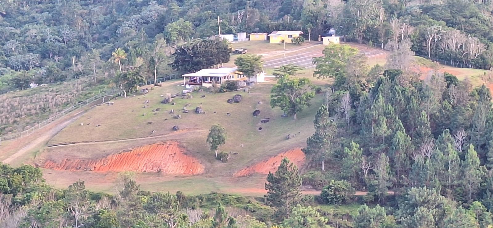
The estate described on this site, about 100 acres in two fee-simple parcels on PR-7722 in Cayey, carries A-G classification on the pasture and farmed land and a B-Q district on part of the property. Together, per the owners' zoning confirmation, that allows the land to be run as a farm or ranch, lived on as a private residence, or developed for eco-tourism, equestrian, veterinary and similar uses. The property previously operated as a working farm raising horses, cattle and chickens and growing produce for San Juan restaurants, and the main residence, second residence, gatehouse and corral are existing improvements. Because the land is already held as two separate parcels, a buyer who wanted to keep one and sell or lease the other would not need a new segregation to do so. As with any property, buyers should verify the classification and their intended use independently; the owners will share the zoning documentation on request through the inquiry form.
For the rest of the due diligence picture, see Buying a farm or mountain estate in Puerto Rico.
Frequently asked questions
Who controls zoning in Puerto Rico?
What does A-G zoning allow?
What is the difference between A-G and A-P?
What do SRC and SREP mean on a listing?
Can I build a house on agricultural land in Puerto Rico?
How do I look up the zoning of a specific parcel?
Sources and further reading
- Puerto Rico Planning Board (Junta de Planificación), Reglamento Conjunto para la Evaluación y Expedición de Permisos, current edition, and the Mapa Interactivo de Puerto Rico.
- Act 94-2015, Las Piedras Agricultural Reserve, for an example of the 50-cuerda minimum segregation rule in protected agricultural land.
- Chambers Real Estate 2026, Puerto Rico Law and Practice, Pietrantoni Méndez & Álvarez LLC, on sources of real property law and zoning.
This article is general information, not legal advice. District names, permitted-use tables and procedures change with each revision of the Reglamento Conjunto and each municipal plan; confirm the current classification and permitted uses for any parcel with a Puerto Rico attorney or licensed planner before purchasing.