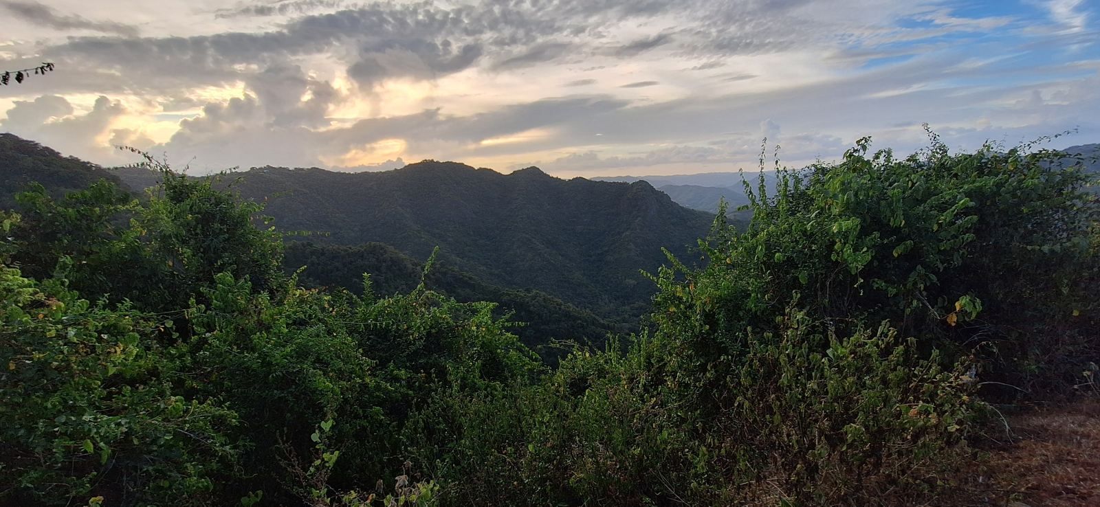
Most people who move to Puerto Rico picture the coast. The people who have lived here longest often picture the mountains. Cayey, a municipality of about 40,000 people in the Sierra de Cayey an hour south of San Juan, has been where the island's governors summer, where San Juan families keep weekend houses, and where Spanish garrison soldiers were once sent to recover from the tropical heat. This guide covers what it is actually like to live there: the climate at different elevations, the drive times, the services, the barrios and the trade-offs against coastal living.
Where Cayey is
Cayey (pronounced kah-YAY, officially Cayey de Muesas) sits in central-eastern Puerto Rico where the Sierra de Cayey meets the Cordillera Central. It borders Cidra and Caguas to the north, Aibonito to the west, Salinas and Guayama to the south, and San Lorenzo to the east. The town was founded in 1773 and grew on tobacco and coffee; today the municipality hosts a University of Puerto Rico campus, a Coca-Cola bottling plant and a regional hospital, and serves as the crossroads where the PR-52 expressway from San Juan to Ponce meets the old PR-1 and PR-14 roads into the interior. The urban center lies at roughly 1,300 to 1,500 feet above sea level; the surrounding ridges rise past 2,000 feet, and neighboring Aibonito's plaza, at 2,401 feet, is the highest in Puerto Rico.
Climate by elevation
Elevation is the whole point of Cayey, so it is worth being precise. In the town itself, long-term averages show daytime highs of about 78°F in January rising to about 84°F in July and August, and overnight lows of about 60°F in winter and 68°F to 69°F in summer. Annual rainfall is around 100 inches, concentrated from May through November, with a drier, cooler stretch from December through March that locals regard as the best months of the year. On winter mornings the temperature in the higher barrios can fall into the 50s, and the valleys fill with the mist that gives Cayey its nickname, la Ciudad de las Brumas.
Above the town the difference grows. A property at 2,100 feet typically runs 10 to 20 degrees cooler than San Juan on the same afternoon, with a steady breeze off the ridges, and is one of the few places on the island where a fireplace or a sweater at dinner is not a joke. Humidity is high, as it is everywhere in Puerto Rico, but the heat load that makes coastal living an indoor, air-conditioned affair for much of the year is largely absent. Many mountain houses run without air conditioning at all, and the covered deck, not the living room, is where life happens.
Drive times
- San Juan metro and Luis Muñoz Marín International Airport: about 35 miles, 50 to 70 minutes via PR-52, depending on traffic and where in the municipality you start. Properties near the expressway are at the short end; properties on the mountain roads toward Aibonito add 15 to 25 minutes.
- Caguas: 20 to 30 minutes north on PR-52, the nearest large commercial center.
- Ponce: about 45 minutes south on PR-52.
- South coast beaches (Salinas, Guayama): 30 to 40 minutes.
- Cayey town center from the outlying barrios: 10 to 25 minutes on winding two-lane roads.
The roads themselves deserve a word. PR-52 is a modern toll expressway. The mountain roads that branch from it (PR-1, PR-14, PR-15, PR-7722, PR-7737 and others) are paved, narrow, steep and curved, with the occasional landslide repair. They are perfectly drivable in an ordinary car, but a weekly commute to San Juan is a different proposition from a daily one, and most residents who work in the metro area do so remotely or on a hybrid schedule.
Hospitals, schools, shopping and services
- Medical. Hospital Menonita de Cayey is a full regional hospital in the town, with the island's major medical centers an hour away in San Juan.
- Education. The University of Puerto Rico at Cayey is a liberal arts campus of the UPR system. The municipality has public schools and private schools, and the private school options widen considerably in Caguas and the metro area.
- Shopping. Supermarkets, pharmacies, hardware and the usual chains are in the town and along PR-1 and PR-14, with a larger selection in Caguas and at Plaza Las Américas in San Juan.
- Utilities. Grid electricity from LUMA and municipal water from AAA reach most of the municipality, but service on remote roads can be intermittent, which is why established mountain properties carry cisterns, generators and increasingly solar. Fiber internet is limited outside town; Starlink has become the standard solution and works well at elevation.
- Agriculture. The Department of Agriculture maintains a regional presence, and the area has a working farm economy of coffee, plantains, vegetables, cattle and horses, with feed stores, veterinarians and farm services available locally.
The barrios: Jájome, Cercadillo, Guavate, La Piedra and the rest
Cayey is divided into some twenty barrios, and the character changes from one to the next.
- Jájome Alto and Jájome Bajo, south of town on PR-15, are the traditional summer-house district. The governor's official summer residence is in Jájome Alto, and the area combines high elevation, long views to the south coast and a settled community of weekend and full-time residents.
- Cercadillo, to the west, is prized for its climate and its views over the south of the island, and has become one of the municipality's most sought-after areas for larger home sites.
- Guavate, on PR-184 toward the Carite Forest, is the lechón capital described below and a mix of farms, forest and weekend traffic.
- La Piedra, Sumido, Toíta, Culebras, Cedro and Lapa are the agricultural barrios along the mountain roads toward Aibonito and Cidra, where the larger fincas and estates lie. PR-7722 through La Piedra, named for the rock face of the same name, runs along the ridge near the Aibonito line at around 2,000 feet.
- Beatriz, Vegas, Rincón and Montellano are closer to the expressway and the town, with newer subdivisions, expressway access and a more suburban feel.
Food, forest and the Ruta Panorámica
Guavate's lechoneras, the open-air restaurants along PR-184 serving whole spit-roasted pork with rice, pigeon peas, pasteles and morcilla, are a Puerto Rican institution and draw visitors from across the island every weekend. Beyond them the road climbs into the Bosque Estatal de Carite, a 6,000-acre state forest with trails and the Charco Azul swimming hole. The Ruta Panorámica, the scenic route that threads the length of the Cordillera Central, passes through the municipality, and the Monumento al Jíbaro Puertorriqueño beside PR-52 honors the mountain farmer who is the island's founding archetype. For residents the daily texture is quieter: roadside fruit stands, horses on the shoulder, the town plaza, and a Saturday drive down to the beach when the mood strikes.
Mountain versus coast: the honest trade-offs
- You gain a cooler climate, privacy and acreage that the coast cannot offer at any price, freedom from storm surge and coastal flood zones, and a lower cost of land per acre.
- You give up the beach at your door, the restaurant density of Condado or Dorado, and five-minute errands. Rain is frequent and roads are winding. Utility resilience is on you.
- Storms affect the whole island. The mountains escape surge but take heavy rain and wind, and the main risks are landslides and extended road and power outages, as Hurricane María demonstrated in 2017. Properties with their own water storage, backup power, good drainage and more than one route out recover fastest.
- Community is Spanish-speaking, long-settled and welcoming to people who make an effort. English is widely understood in town and in professional settings, but daily life in the barrios is in Spanish.
The property market
Cayey's market runs from small lots in town at $75,000 to $150,000, through houses on a cuerda or two in the $300,000 to $1,000,000 range, to large parcels and estates. In late 2026, raw mountain acreage in large tracts has been offered at roughly $8,000 to $20,000 per acre, and improved estates with a residence and significant land between $1,500,000 and $4,000,000. Demand at the upper end has grown with relocating Act 60 decree holders, who value the privacy and the climate and are required to purchase a residence on the island within two years of their decree.
The estate described on this site is one of those properties: about 100 acres in La Piedra at roughly 2,100 feet, gated, with a remodeled three-bedroom residence, a second house, two creeks, a well and cistern, trails to a summit lookout and A-G agricultural zoning, about an hour from San Juan. It is offered for sale at $2,375,000, reduced from $2,500,000, on a furnished long-term lease at $15,000 per month, or as a lease with option to buy. Photographs and details are on the main page, and private visits can be arranged through the inquiry form. For the mechanics of buying rural land here, see Buying a farm or mountain estate in Puerto Rico.
Frequently asked questions
How far is Cayey from San Juan?
What is the weather like in Cayey?
Does Cayey get hurricanes?
Is there a hospital in Cayey?
What is Guavate?
Why do wealthy San Juan families keep homes in Cayey?
Sources and further reading
- Cayey climate averages, US Climate Data.
- Cayey, Puerto Rico, Welcome to Puerto Rico (topuertorico.org), on history, attractions and climate.
- Cayey, the City of Mists, Boricua Online, on geography, barrios and elevation.
Figures are long-term averages and typical drive times; conditions vary by location within the municipality. Information about the Cayey estate is provided by the owner and should be independently verified.