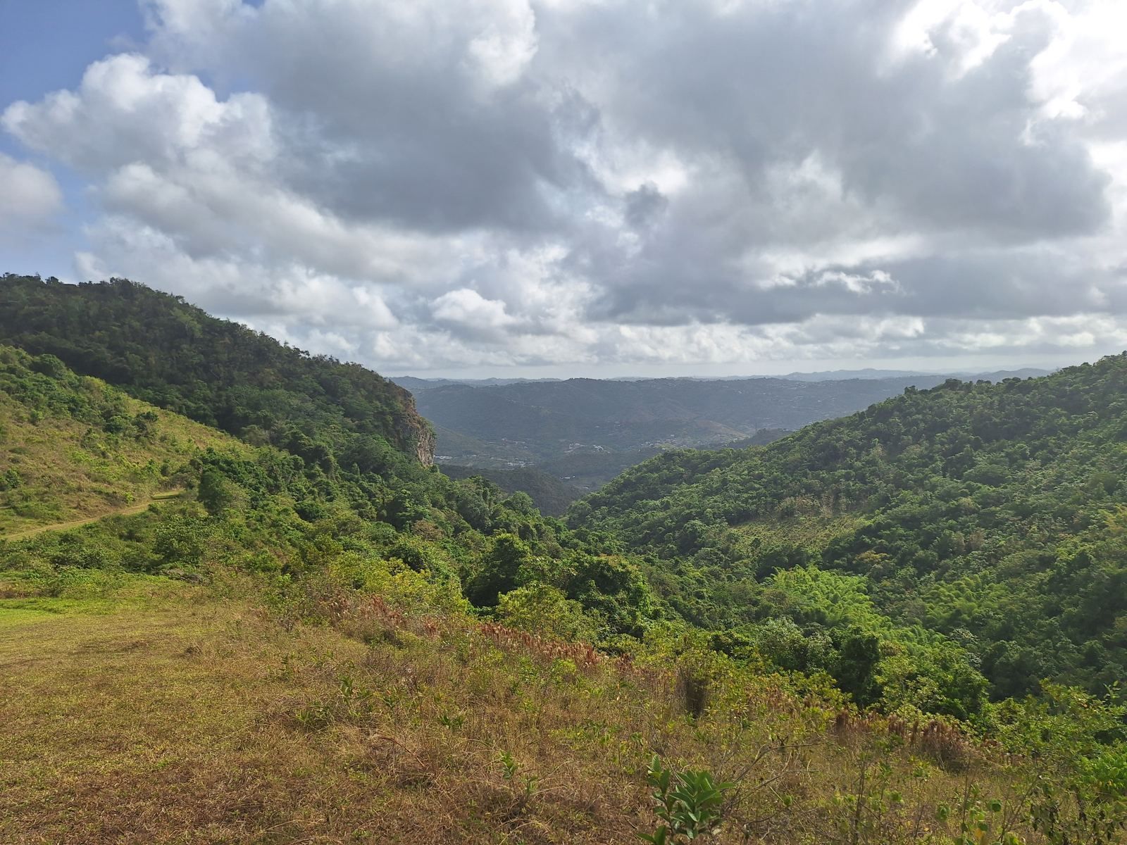
Puerto Rico's interior is one mountain range, the Cordillera Central and its eastern extension the Sierra de Cayey, but it is not one market. The towns along it differ in elevation, climate, distance from San Juan, farm economy and price, and the right one for a weekend house is not necessarily the right one for a working estate or a full-time relocation. This guide compares the six areas that come up most often when buyers look at mountain property: Jájome and Cercadillo in Cayey, Aibonito, Barranquitas, Adjuntas and Utuado.
The six areas at a glance
Elevations below are from the Puerto Rico government's GIS office, based on USGS data, and give each municipality's average and highest point; town centers sit lower than the ridges where estates are usually found. Drive times are typical daytime times to the San Juan metro area and the Luis Muñoz Marín airport.
- Cayey (Jájome, Cercadillo, La Piedra): municipal average about 1,700 feet, highest point about 2,950 feet. About 1 hour to San Juan via PR-52. Established second-home district, mixed farm economy, best access of the six.
- Aibonito: average about 1,850 feet, highest about 2,820 feet; the plaza at 2,401 feet is the highest town center on the island. About 1 hour 20 minutes to San Juan. Cool, floral, small-town.
- Barranquitas: average about 2,070 feet, highest about 3,080 feet. About 1 hour 15 to 30 minutes to San Juan. Dramatic terrain, the San Cristóbal canyon, fewer outside buyers.
- Adjuntas: average about 2,180 feet, highest about 3,935 feet; the town itself sits at about 2,300 feet. About 2 hours to San Juan, 40 minutes to Ponce. Coffee country, coldest recorded temperatures on the island.
- Utuado: average about 1,290 feet, highest about 3,215 feet. About 1 hour 45 minutes to San Juan, 40 minutes to Arecibo. Lakes, karst, coffee haciendas, largest municipality by area in the group.
- Jayuya and Orocovis (honorable mentions): the highest ground on the island, with Cerro de Punta at 4,390 feet in Jayuya, but remote and thinly served; worth a look only for buyers who want to be far from everything.
Jájome and Cercadillo (Cayey)
Cayey is where the mountain second-home tradition started, and for a simple reason: it is the only true mountain municipality on the PR-52 expressway, which puts San Juan, the airport and the Caguas shopping belt about an hour away. Jájome Alto, on PR-15 south of town, holds the governor's official summer residence and a long-established community of weekend and full-time houses with views to the south coast. Cercadillo, to the west, has become the municipality's most sought-after area for larger home sites, prized for its climate and its panorama over the southern plains. The agricultural barrios toward the Aibonito line, La Piedra, Sumido, Culebras and Cedro, are where the large fincas and estates sit, on ridges around 2,000 feet.
Climate in the town runs from highs near 78°F in winter to the mid 80s in summer with winter lows around 60°F; on the ridges it is 10 to 20 degrees cooler than San Juan on the same afternoon. Services are the best of the six: a regional hospital (Menonita), a UPR campus, supermarkets and chain stores, and Guavate's lechoneras for weekend food. Prices reflect the access: raw mountain land in large tracts around $8,000 to $20,000 per acre in 2026, small lots far higher, and improved estates from about $1,500,000 to $4,000,000. Buyers are San Juan professionals, returning Puerto Ricans and, increasingly, Act 60 relocators who want privacy within reach of the metro area. A fuller picture of the municipality is in Living in Cayey, Puerto Rico.
Aibonito
Immediately west of Cayey and sharing its sierra, Aibonito is smaller, higher and colder. Its nicknames tell the story: La Ciudad de las Flores for the flower nurseries and the annual Festival de las Flores, and La Nevera, the refrigerator, for its temperatures. The town plaza at 2,401 feet is the highest in Puerto Rico, and the surrounding ridges such as La Sierra and Asomante reach past 2,000 feet with views north and south. The Cañón de San Cristóbal, the island's deepest gorge, forms part of the border with Barranquitas.
Access is by PR-14 or PR-162 from the Cayey side, or PR-173 from the north, all mountain roads, which adds 20 to 30 minutes over Cayey for the San Juan trip. The town has a hospital (Menonita also operates here), schools and a compact commercial center. The economy is horticulture, poultry and dairy, with a long tradition of family farms. Prices are a step below Cayey for comparable land, and the buyer pool is more local: San Juan families with roots in the town, retirees returning from the mainland, and a growing number of relocators who found Cayey's best parcels taken. For a buyer who wants the coolest livable climate within a reasonable drive of San Juan, Aibonito is the answer.
Barranquitas
North and west of Aibonito, Barranquitas is the most rugged of the eastern group, with an average elevation above 2,000 feet and ridges over 3,000. It is known for the San Cristóbal canyon, for the birthplace of statesman Luis Muñoz Rivera, and for its artisan fair. The terrain is steep, the valleys deep and the views spectacular, and parcels of 40 to 50 acres with river frontage have been offered at a fraction of Cayey prices. Access is by PR-152 or PR-156, winding roads from Comerío and Aibonito, which puts San Juan at about 1 hour 15 to 30 minutes on a good day.
Barranquitas has seen fewer outside buyers than Cayey or Aibonito, which cuts both ways: more land for the money and more privacy, but thinner services and a market where resale takes longer. It suits a buyer who wants acreage, water and seclusion and does not need to be in San Juan more than once a week.
Adjuntas
Adjuntas sits in the heart of the Cordillera Central in the island's west-center, at about 2,300 feet in the town and nearly 4,000 feet at its highest point. It calls itself La Suiza de Puerto Rico and La Ciudad del Gigante Dormido, after the profile of the surrounding peaks, and it earns the Swiss comparison: average yearly temperature is around 70°F, winter nights are usually in the 55 to 60°F range and drop to the mid 40s after cold fronts, and the island's record low, 38°F, was set here in 2018. This is the center of Puerto Rico's coffee production, with working haciendas that offer tours and tastings, the Lago Garzas reservoir, and Casa Pueblo, the community institution that fought open-pit copper mining in the 1980s and now runs a solar microgrid.
The trade-off is distance. Adjuntas is about two hours from San Juan and about 40 minutes from Ponce, which has an airport with limited service and a full set of hospitals and shopping. The buyer here is someone building a life around the land: coffee or agro-tourism operators, off-grid and sustainability-minded relocators, and mainland buyers who have decided that the coast is not for them. Large estates do come to market, including coffee haciendas on 20 to 70 acres priced from the low millions, and the price per acre for raw land is generally below Cayey.
Utuado
North of Adjuntas and the largest municipality in the group by area, Utuado is lake and karst country: the Dos Bocas and Caonillas reservoirs, limestone hills, caves and river valleys, with coffee on the higher ground. Its average elevation is lower than the others, about 1,300 feet, because the municipality runs down toward the north coast, but its southern barrios climb past 3,000 feet. The Caguana Indigenous Ceremonial Center is here, and the Río Abajo and Toro Negro forests are nearby.
Access is from Arecibo on PR-10, about 40 minutes, and from there to San Juan on PR-22, for a total of roughly 1 hour 45 minutes. Utuado has a hospital and the usual town services, but it was among the hardest-hit municipalities in Hurricane María and some outlying roads remained difficult for years. The market has a wide range: small farms at modest prices, lakefront land, and the occasional large coffee estate marketed to the same buyer who looks at Adjuntas. It is the choice for someone who wants water views in the mountains and is comfortable being closer to Arecibo than to San Juan.
How to choose
- You will commute to San Juan weekly or more: Cayey, then Aibonito. Nothing else is realistic.
- You want the coolest climate: Adjuntas or Aibonito, with Barranquitas close behind.
- You want the most land for the money and maximum privacy: Barranquitas, Utuado or Adjuntas.
- You want a working coffee or agro-tourism operation: Adjuntas or Utuado for the supply chain and the story; Cayey for the access.
- You want a second home that will resell: Cayey's Jájome and Cercadillo have the deepest buyer pool, followed by Aibonito.
- You need an Act 60 principal residence with privacy: Cayey or Aibonito, because the residency tests reward being present and connected to the island, and both are close enough to the professional and social infrastructure of the metro area to make that easy. See The Act 60 real estate requirement.
Whichever area you choose, the due diligence is the same: zoning classification, water source and rights, access easements, flood and landslide exposure, and reconciliation of deed, survey and tax records. Those steps are covered in Buying a farm or mountain estate in Puerto Rico and Puerto Rico zoning codes for rural land.
Example: a 100-acre estate in La Piedra, Cayey
The estate described on this site illustrates the Cayey end of the comparison. It is about 100 acres in two fee-simple parcels at roughly 2,100 feet on PR-7722 in the La Piedra barrio, near the Aibonito line: gated, with a remodeled three-bedroom residence, a second house for renovation, two creeks, a 550-foot well and a 12,000-gallon cistern, municipal water and power, Starlink internet, trails to a summit lookout, and A-G agricultural and B-Q zoning. Property tax is about $990 a year. San Juan and the airport are about an hour away. It is offered for sale at $2,375,000, reduced from $2,500,000, on a furnished long-term lease at $15,000 per month, or as a lease with option to buy, and is listed on Stellar MLS as PR9124119. Photographs and details are on the main page, and private visits can be arranged through the inquiry form.
Frequently asked questions
Which Puerto Rico mountain town is closest to San Juan?
Which is the coolest town in Puerto Rico?
Where do San Juan families keep weekend homes?
Is mountain land cheaper than coastal land in Puerto Rico?
Which mountain area is best for a working farm?
How did Hurricane María affect the mountain towns?
Sources and further reading
- Elevaciones de los Municipios, Government of Puerto Rico GIS office (USGS data), for minimum, maximum and average elevations by municipality.
- Adjuntas, Puerto Rico, Wikipedia, for elevation, climate, record low and coffee production.
- Aibonito, Puerto Rico, Wikipedia, for the plaza elevation and nicknames.
- Cayey climate averages, US Climate Data.
Drive times are typical daytime estimates and vary with traffic and weather. Price ranges reflect asking prices observed in late 2026 and are not appraisals. Information about the Cayey estate is provided by the owner and should be independently verified.