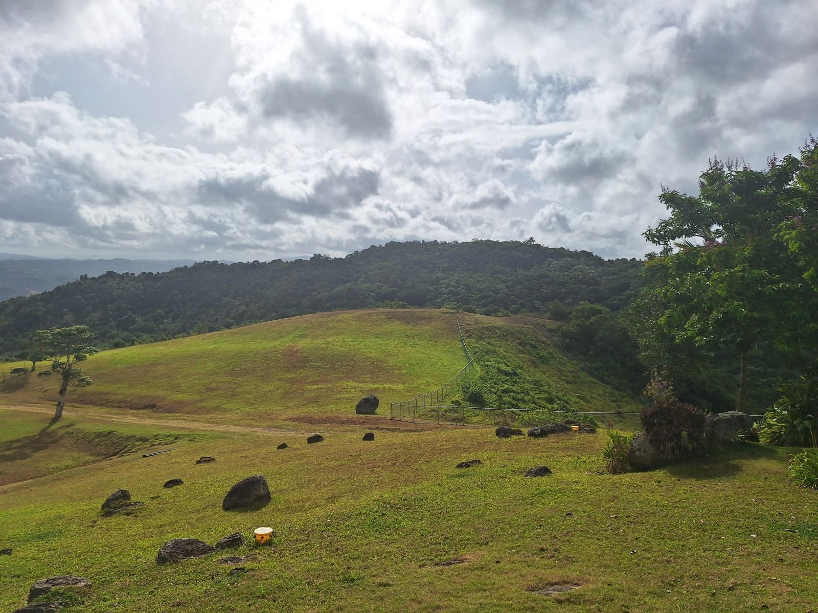
If you want to live in Puerto Rico without living in the heat, go up. The coolest places on the island are the towns of the Cordillera Central, the mountain spine that runs east to west through the middle of Puerto Rico. Aibonito, Adjuntas, Barranquitas, Cayey and Jayuya sit between about 1,300 and 2,400 feet, where average lows fall into the high 50s and low 60s Fahrenheit in winter and many homes never need air conditioning. This guide compares them by elevation, temperature, rainfall, character and distance from San Juan.
Why elevation is the whole answer
Puerto Rico sits at about 18 degrees north latitude, so the coast is warm all year. San Juan's overnight lows average in the mid 70s Fahrenheit under NOAA's 1991 to 2020 normals, and summer afternoons on the coast are hot and humid enough that most residents live indoors with air conditioning from May through October. Latitude cannot be changed, but altitude can. Air cools as it rises, by a few degrees Fahrenheit for every 1,000 feet, so a town at 2,000 feet starts every day noticeably cooler than one at sea level. The mountains also catch the trade winds and the clouds that come with them, which brings breezes, morning mist and more rain.
The practical effect is that the island has two climates. The coast is tropical. The interior above roughly 1,500 feet is closer to a perpetual late spring, with days in the high 70s to low 80s and nights that call for a light blanket in winter.
The cool mountain towns, from highest to lowest
Aibonito, about 2,400 feet
Aibonito's main plaza, at about 2,401 feet, is the highest town center in Puerto Rico, and the town's nicknames say the rest: la Ciudad Fría (the Cold City) and la Nevera de Puerto Rico (Puerto Rico's refrigerator). Under the 1991 to 2020 normals its annual average high is about 78°F and its average low about 65°F, with February lows averaging about 61°F and January highs about 74°F. Its record low, 40°F, was set in 1911. Aibonito is also the City of Flowers, with a nursery industry and a well-known flower festival. It sits in the Sierra de Cayey between Cayey and Barranquitas, roughly an hour and 10 minutes from the San Juan airport.
Adjuntas, about 2,300 feet
Adjuntas calls itself la Suiza de Puerto Rico, the Switzerland of Puerto Rico. At about 2,316 feet it has the coolest nights of any town with long-term records: an annual average low of about 60.5°F and a February average low near 55.6°F. Days are warmer than Aibonito's, with an annual average high around 82°F, because the town sits in a valley that heats up in the afternoon. Adjuntas is coffee country in the western Cordillera, quiet and agricultural, and about two hours from San Juan.
Barranquitas, about 2,000 feet
Barranquitas, at about 2,000 feet just north of Aibonito, averages highs of about 80°F and lows of about 64°F, with February lows near 61°F. It is one of the most scenic towns on the island, set in a bowl of steep ridges and home to the San Cristóbal Canyon on its boundary with Aibonito. Rainfall is lower than in the wetter western mountains, around 48 inches a year. San Juan is about an hour away.
Cayey, about 1,300 to 2,200 feet
Cayey's town center sits around 1,300 to 1,500 feet, and its weather station shows highs from about 78°F in January to the mid 80s in summer, with winter lows around 60°F to 62°F. The municipality climbs much higher than the town: the ridges of La Piedra, Jájome and Cercadillo reach past 2,000 feet and run several degrees cooler. Cayey's advantage is access. The PR-52 expressway puts the San Juan metro area and the airport about 50 to 70 minutes away, with a regional hospital, a University of Puerto Rico campus and full shopping in town. See Living in Cayey, Puerto Rico for the full picture.
Jayuya, about 1,400 to 3,000 feet
Jayuya's town sits around 1,450 feet, with typical temperatures between about 62°F and 82°F through the year and February the coolest month. The municipality includes Cerro de Punta, Puerto Rico's highest peak at about 4,390 feet, so homes on its upper slopes are among the coolest on the island. It is a strongly Taíno-heritage town known for its coffee and its festival, and it is remote: plan on about an hour and 45 minutes to San Juan.
Utuado, Orocovis and Cidra
Utuado is a large, rugged municipality whose peaks reach about 3,126 feet at Cerro Morales; the town itself is lower and warmer, and the PR-10 highway now brings the San Juan area within about an hour and a half. Orocovis sits at the geographic center of Puerto Rico, best known for the Toro Verde adventure park, with high ridges and cool nights on its upper roads. Cidra, east of Cayey around Lago de Cidra, is a little lower but has long been a favorite of San Juan commuters for its climate and its 45-to-60-minute drive.
Maricao, the wettest and coldest-feeling
Maricao in the far west is surrounded by a state forest and is the wettest station on the island, averaging about 93 inches of rain a year. Summer days reach the mid 80s, but winter nights can drop to about 40°F, and it is the most remote town on this list, two and a half to three hours from San Juan.
Quick comparison
| Town | Elevation (approx.) | Typical lows (winter) | Annual avg high | Drive to San Juan |
|---|---|---|---|---|
| Aibonito | 2,400 ft | about 61°F | about 78°F | about 1 hr 10 min |
| Adjuntas | 2,300 ft | about 56°F | about 82°F | about 2 hr |
| Barranquitas | 2,000 ft | about 61°F | about 80°F | about 1 hr |
| Cayey (town) | 1,300 to 1,500 ft | about 60 to 62°F | low 80s | 50 to 70 min |
| Jayuya (town) | 1,450 ft | about 62°F | about 82°F (peak month) | about 1 hr 45 min |
| Maricao | varies | can reach 40°F | mid 80s in summer | 2.5 to 3 hr |
| San Juan (for comparison) | sea level | mid 70s | mid to upper 80s |
Figures are long-term averages from NOAA-based normals as reported by the sources listed below, rounded; drive times are typical non-rush-hour estimates to the San Juan airport.
Your property's elevation matters more than the town's
Town climate figures come from a single station, usually in the valley where the town was built. In the mountains, a house 700 feet above the plaza on an exposed ridge can be 5 degrees cooler than the station and catch a steady breeze, while a house in a sheltered hollow can be warmer and stiller than the numbers suggest. When you shop, look up the parcel's elevation on a topographic map, visit in the afternoon as well as the morning, and ask the owner whether the house needs air conditioning. On the higher ridges of Cayey, Aibonito, Jayuya and Adjuntas, the honest answer is often no.
Exposure also decides how wet it feels. East-facing slopes catch the trade winds first and the clouds that come with them; south-facing slopes in the Sierra de Cayey, which look toward the Caribbean coast, are sunnier and drier. If you plan on solar panels, a south or southeast exposure is worth paying for. For more on that, see Off-grid and self-sufficient properties in Puerto Rico.
The honest trade-offs
- Rain and humidity. Cooler air comes with more cloud. Aibonito and Caguas receive more rain than San Juan, and Maricao more than half again as much. Mold and mildew need managing in closed houses.
- Roads. Mountain roads are paved but narrow, steep and curved. A weekly trip to San Juan is easy; a daily commute is a commitment.
- Services. Cayey has a full regional hospital and shopping; the more remote towns depend on Caguas, Ponce or San Juan for specialists and big-box stores.
- Utilities. Grid power and municipal water reach most roads, but service on remote roads is less reliable, which is why established mountain homes carry cisterns, generators or solar.
- Storms. The mountains escape storm surge, but steep slopes are where Hurricane María caused tens of thousands of landslides in 2017. See Hurricane-safe places to live in Puerto Rico for how to check a parcel.
- Language and community. Mountain towns are Spanish-speaking and long-settled, and welcoming to newcomers who make the effort.
For a side-by-side look at where second-home buyers actually purchase in these areas, see Puerto Rico's mountain second-home areas compared, and for a broader view of life away from the coast, Relocating to Puerto Rico outside San Juan.
An example at 2,100 feet
The estate described on this site shows what the higher ridges offer. It covers about 100 acres in two fee-simple parcels at roughly 2,100 feet on PR-7722 in Cayey, near the Aibonito line, about an hour from San Juan. The remodeled three-bedroom main house is built around a long covered deck facing the valley, and like many homes at this height it is comfortable most of the year on the breeze alone. There is a second residence, A-G and B-Q zoning, municipal water plus a 550-foot well, a 12,000-gallon cistern and two creeks, Starlink and a generator hookup, and property tax of about $990 a year. It is offered for sale at $2,375,000, reduced from $2,500,000, on a furnished long-term lease at $15,000 a month, or as a lease with option to buy (Stellar MLS PR9124119). See the photographs and details on the main page or arrange a visit to feel the temperature for yourself.
Frequently asked questions
What is the coolest town in Puerto Rico?
How much cooler are the mountains than San Juan?
Does it ever get cold in Puerto Rico?
Which cool mountain town is closest to San Juan?
Do I need air conditioning in the Puerto Rico mountains?
What are the downsides of living in the Puerto Rico mountains?
Sources and further reading
- Aibonito, Puerto Rico, Wikipedia, for elevation, 1991 to 2020 climate normals, the 40°F record low and nicknames.
- Adjuntas, Puerto Rico, Wikipedia, for elevation, climate normals and drive time.
- Barranquitas climate, US Climate Data.
- Average weather in Jayuya, WeatherSpark.
- Maricao State Forest, Wikipedia, for rainfall and winter lows.
- Annual average temperatures and rainfall in Puerto Rico, Current Results, for rainfall comparisons.
- Utuado, Puerto Rico, Wikipedia, for peak elevations and the PR-10 drive time.
Climate figures are long-term averages and vary by exact location and exposure within each municipality; drive times are estimates. This article is general information, not a guarantee of conditions at any property. Information about the Cayey estate is provided by the owner and should be independently verified.