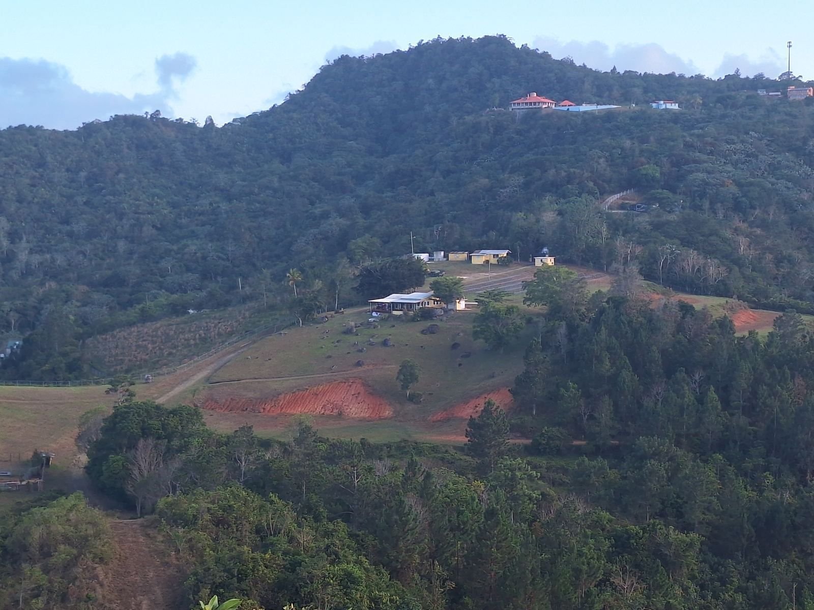
There is no hurricane-proof address in Puerto Rico. The whole island sits in the Atlantic hurricane belt, and in 2017 Hurricane María crossed it from corner to corner. What you can choose is which hazards a property faces, and how well it is built to ride them out. Storm surge threatens the coast, river flooding threatens low valleys, wind reaches everywhere, and landslides threaten steep, saturated slopes. The safest homes sit above all four: on stable ground, well above sea level and outside stream floodplains, with their own water and power. This guide explains each hazard, what María revealed, and how to check a specific parcel before you buy.
What Hurricane María showed
María made landfall near Yabucoa, on the southeast coast, early on September 20, 2017, as a high-end Category 4 hurricane with winds of about 155 mph. Its eye had widened to between 10 and 32 miles across, which spread the strongest winds over a large area as the storm crossed the island toward the northwest. Rainfall totals reached about 38 inches in Caguas. Along the north coast, surge and flash flooding trapped thousands of residents in Toa Baja, where water rose 6 feet in half an hour, and parts of San Juan flooded waist-deep. In the interior, the rain triggered more than 70,000 landslides; some municipalities, Utuado among them, recorded more than 25 per square mile, cutting roads and bridges for weeks.
The longest-lasting damage was to infrastructure. All 3.4 million residents lost power; three months later about 45 percent were still without it, and full restoration took until August 2018. The official estimate of deaths in Puerto Rico was later revised to 2,975, most of them in the months after the storm rather than during it. The lesson for a property buyer is that surviving the storm is only half the question. The other half is how a household gets through the weeks without the grid, the water utility or the road.
The four hazards, and where each one strikes
Storm surge
Surge is seawater pushed ashore by the storm's winds and low pressure. It is the deadliest hurricane hazard in most places, and it is purely coastal: it affects low-lying land along the shore and the lower reaches of rivers. A property a few miles inland and a few hundred feet above sea level has no surge exposure at all.
Flooding from rain
Heavy rain floods rivers and streams far inland. In Puerto Rico the worst river flooding happens on the coastal plains and in the broad valleys, where water from the mountains collects, and in narrow mountain valleys along creek beds, where flash floods rise fast. FEMA maps the 1 percent annual chance floodplain, the "100-year" flood, on its Flood Insurance Rate Maps.
Wind
Wind reaches every part of the island, and exposed ridges and coasts take the strongest gusts. During María, gusts of 118 mph were recorded at Camp Santiago in Salinas and 113 mph in San Juan. Wind is managed through construction rather than location: Puerto Rico's reinforced concrete homes generally performed far better than wood-frame structures and light roofs.
Landslides
Landslides are the mountain hazard. After María, the USGS and the University of Puerto Rico at Mayagüez mapped the island's susceptibility to rainfall-triggered landslides. About 1 percent of the island rates as extremely high susceptibility, 9 percent very high, 20 percent high, 40 percent moderate, and 30 percent low, the low-risk land being mostly flatter ground near the coasts. Soil type was the strongest predictor, with slope steepness and soil moisture close behind, and most of María's landslides occurred on slopes of 25 to 45 degrees.
Coast, valley and mountain compared
- Coastal lowlands (much of metro San Juan, Toa Baja, Cataño, the south and east coasts): exposed to surge and river flooding, and to the strongest winds where a storm makes landfall. Low landslide risk. Fastest to regain services after a storm.
- Interior valleys and plains (Caguas, Juncos, parts of Cidra and Gurabo): no surge, but river flooding where streams converge. Caguas recorded María's highest rainfall.
- Mountain ridges and plateaus (the higher parts of Cayey, Aibonito, Barranquitas, Adjuntas, Jayuya and similar): no surge and little river flooding away from creek beds. Landslide risk varies parcel by parcel with soil and slope. Roads and utilities take longer to restore.
A ridge-top or plateau property on stable, gently sloping ground in the mountains therefore avoids the two hazards that cause the most loss of life on the coast, surge and flooding, while managing the landslide hazard through site selection. Its main exposure is to wind and to time without services, both of which construction and self-sufficiency address.
How to check a specific parcel
- Flood zone. Look up the parcel on FEMA's Flood Insurance Rate Map or on the Puerto Rico Planning Board's geographic viewer, which displays the FIRM zones and the advisory base flood elevations adopted after María. Zones beginning with A or V are special flood hazard areas; V zones face wave action on the coast. Zone X is outside the 1 percent floodplain. Listings in Puerto Rico often state the zone, but confirm it yourself.
- Coastal exposure. For any property near the shore, NOAA's Coastal Flood Exposure Mapper shows surge and sea-level exposure at higher resolution for Puerto Rico.
- Landslide susceptibility. The USGS susceptibility map shows the relative risk for the area around a parcel. USGS cautions that it is not meant to assess individual properties; in high or very high areas, have a geologist or a geotechnical engineer walk the site before you build or buy.
- The ground itself. Look for cracked slabs or retaining walls, leaning trees or poles, broken water lines and fresh scarps, all of which USGS lists as warning signs. Note where the house sits relative to cut slopes and fill.
- History. Ask neighbors and the owner what happened in María and in Fiona (2022): did water reach the house, did the road close, how long was the power out?
- Insurance quote. Get a windstorm and flood quote before you commit; the price is a summary of the insurer's view of the risk. See Insuring rural property in Puerto Rico.
What a resilient property has
- Reinforced concrete construction with a concrete roof or a well-anchored roof, and impact-rated windows or storm shutters.
- A site on stable ground, outside creek floodplains and away from the edge of steep cut or fill slopes, with drainage that carries water away from the house.
- Water independence: a cistern sized for weeks, not days, and ideally a well, plus a pump that runs on backup power.
- Power independence: a standby generator with a transfer switch, or solar with battery storage, or both. See Off-grid and self-sufficient properties in Puerto Rico.
- Connectivity: satellite internet, which kept working for many households when cell towers and fiber did not.
- Access: a paved road with more than one route out, and room to store fuel, food and supplies.
An example on a Cayey ridge
The estate described on this site illustrates the mountain approach. It covers about 100 acres in two fee-simple parcels at roughly 2,100 feet on PR-7722 in Cayey, near the Aibonito line, far above any storm-surge zone and about an hour from San Juan. For the days after a storm it has municipal water plus a 550-foot well, a 12,000-gallon cistern and two creeks, a generator hookup and Starlink internet, and the remodeled three-bedroom main house is joined by a second residence. The land carries A-G and B-Q zoning and annual property tax of about $990. It is for sale at $2,375,000, reduced from $2,500,000, available on a furnished long-term lease at $15,000 a month, or as a lease with option to buy (Stellar MLS PR9124119). As with any property, a buyer should review the flood and landslide maps and walk the site; details are on the main page, and visits can be arranged through the inquiry form.
Frequently asked questions
Is any part of Puerto Rico safe from hurricanes?
Are the mountains safer than the coast in a hurricane?
How do I check a property's flood zone in Puerto Rico?
Where are landslides most likely in Puerto Rico?
Does a property outside a flood zone need flood insurance?
What makes a Puerto Rico home resilient to hurricanes?
Sources and further reading
- Hurricane Maria, Wikipedia, for landfall, wind, rainfall, flooding, power outage and death toll figures in Puerto Rico.
- New USGS map can help Puerto Rico deal with risk of landslides after hurricanes, US Geological Survey.
- Puerto Rico Landslide Hazard Mitigation Project, US Geological Survey.
- Utuado, Puerto Rico, Wikipedia, for landslide density and road damage after María.
- Flood zones, Programa del Estuario de la Bahía de San Juan, on FEMA flood zone designations in Puerto Rico.
- Coastal Flood Exposure Mapper in Puerto Rico, NOAA Office for Coastal Management.
- Puerto Rico Advisory Base Flood Elevations map service, FEMA.
This article is general information, not engineering, geological or insurance advice. Hazard maps show relative risk, not the condition of any individual parcel; have a qualified professional evaluate a specific property. Information about the Cayey estate is provided by the owner and should be independently verified.